Multi-scale morphodynamics of sand barrier driven by monsoon/typhoon conditions
Methodology
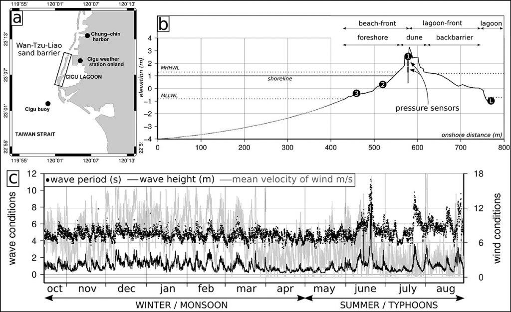
In the framework of the KUNSHEN project, 7 months of monitoring (2011-2012) provided 20 topobathymetric surveys (within a 350 m long segment of the barrier from a water depth of ~ 1.5 m below the lowest tide level to the back-barrier) and acquisitions of nearshore hydrodynamics including velocity profiling and free surface measurement. Morphologic changes were monitored using D-GPS each week during winter monsoon season and just before and after each event during summer typhoon season. Offshore waves were extracted at Cigu buoy (1,5 km off the coast in 18 m of water depth). Additionally, nearshore waves and water level on the beach were acquired from the current profiler deployed 400 m off the coast in 4 m of water depth and a network of pressure sensors deployed along a cross- section through the barrier, respectively (figure 1).
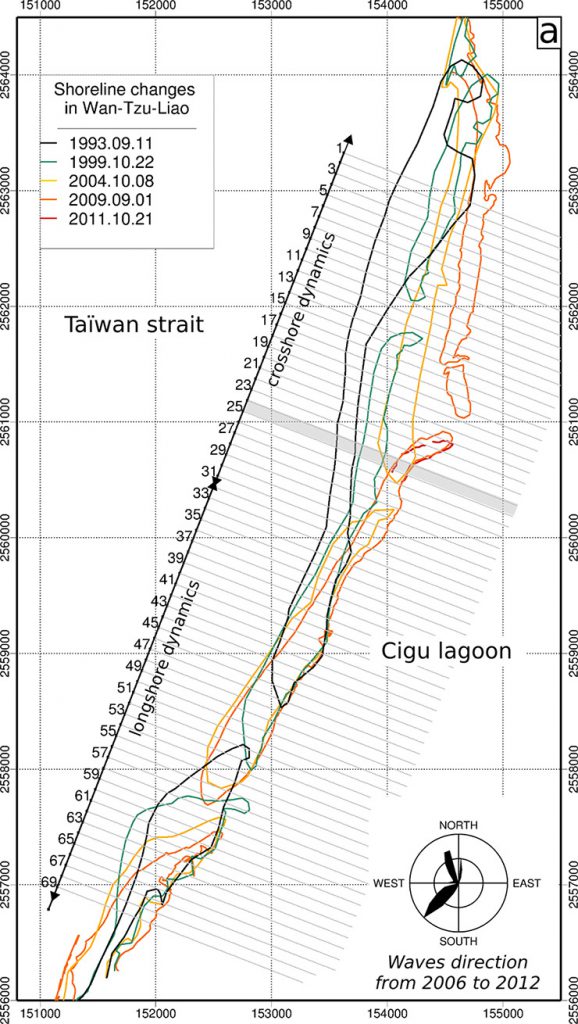
Analysis at the decadal time scale was supported by a data set of shoreline position changes of the whole sand barrier measured in September/October of 1993, 1999, 2004 and 2009 years. Analysis of shoreline changes since 1993, were performed along 70 cross-shore transects separated from 100 m each others (figure 3).
Morphological changes driven by typhoon, a group of typhoons, the whole season and two decades
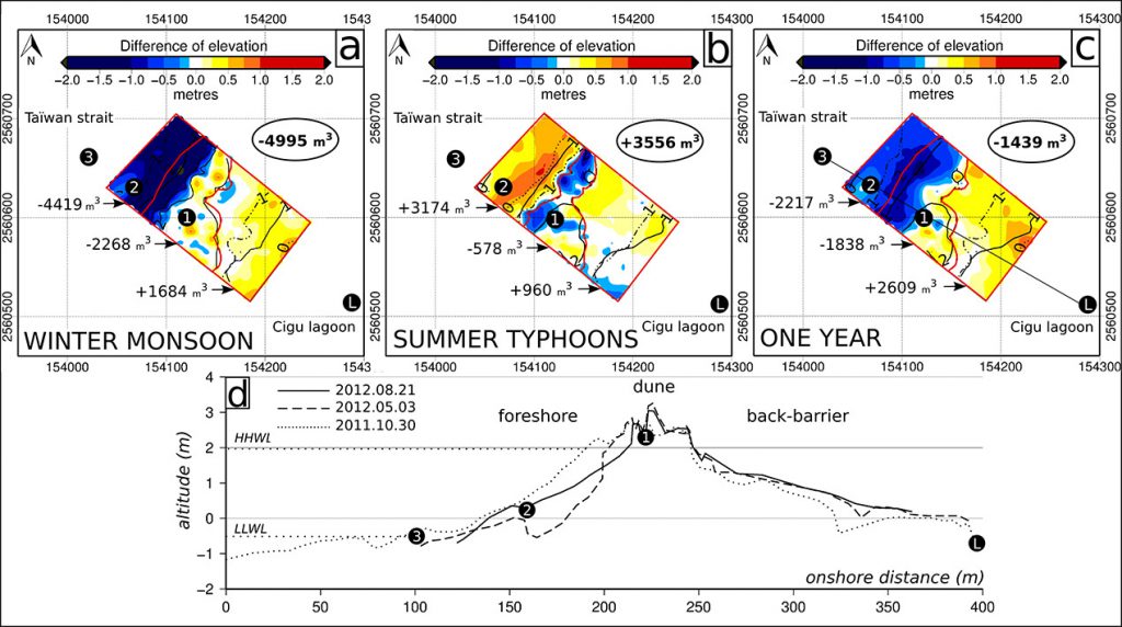
Amongst the eight studied typhoons, TALIM is the most energetic and representative event observed of the seasonal pattern. Offshore wave height reached \(H_{1/3}\) = 10,34 m (\(T_{p}\) = 14,6 s) at Cigu buoy and \(H_{s}\) = 2,3 m (\(T_{p}\) = 13,4 s) at the profiler. At the storm apex, the dune-top (3 m above mean sea level) has been surged. Morphological changes included 6,7 m of dunefoot retreat and a sand transfer from a dune breach to wash-over deposits in the lagoon. More surprisingly, the upper-foreshore was nourished as well as the whole sand barrier (+1920 m3 +/- 822 m3).
Although winter are erosive season (-4995 m3 +/- 1045 m3), the summer results in an accretion period (+3556 m3 +/- 1045 m3) with a foreshore nourishment and 10,4 m of shoreline seaward shift (figure 1). Over the annual time period, the sand barrier recorded 18,5 m of retreat without any significant abrasion of the dune-top or significant sand loss (-1439 m3 +/- 1045 m3).
At the decadal scale, the shoreline changes between 1993 and 2009 evidence cross-shore processes in the north part of the barrier (retreat at about 41 m/yr) and longshore processes in the south (figure 3). Although the chronic landward migration displays several stages, the strong losses of the barrier area occurs only since 2004 and call into question the general concept of conservation of mass during the roll-over of a barrier.